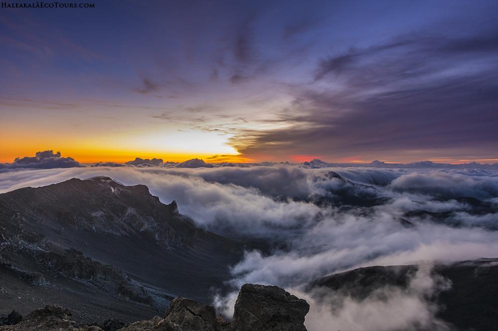
Haleakala’s presence is impossible to miss.
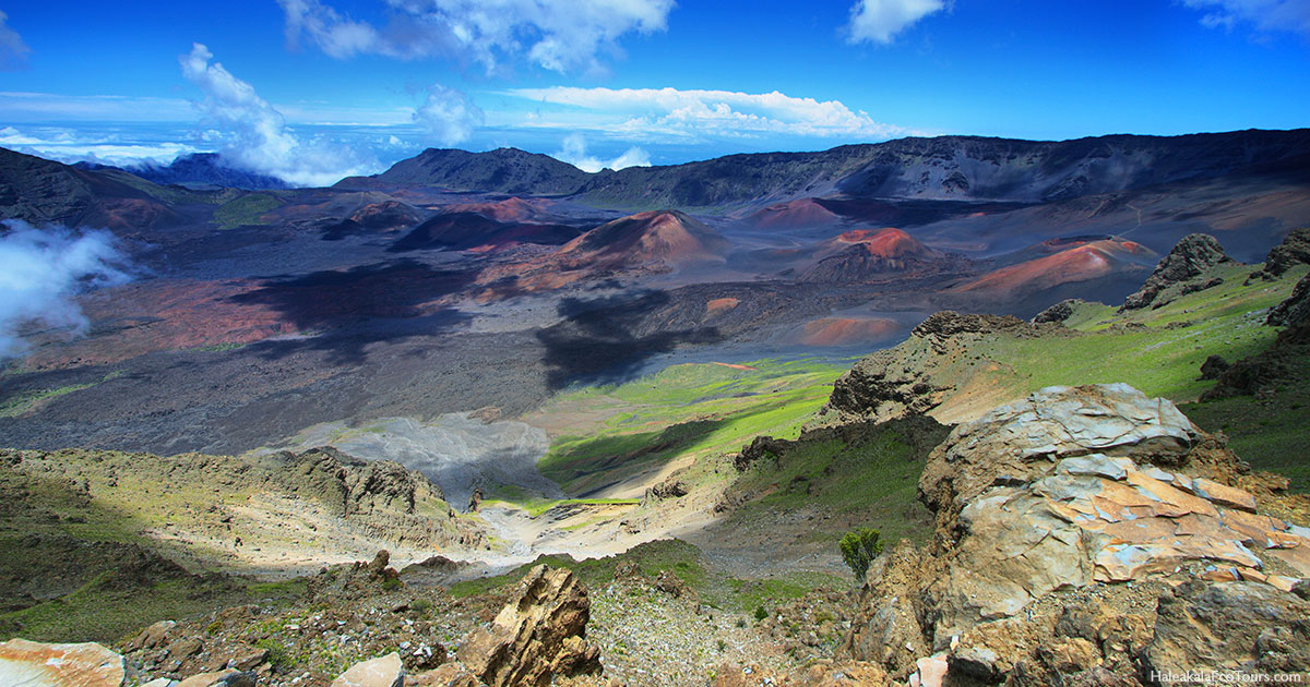
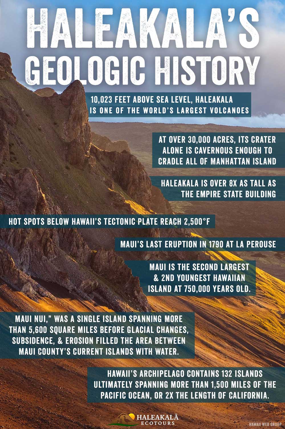
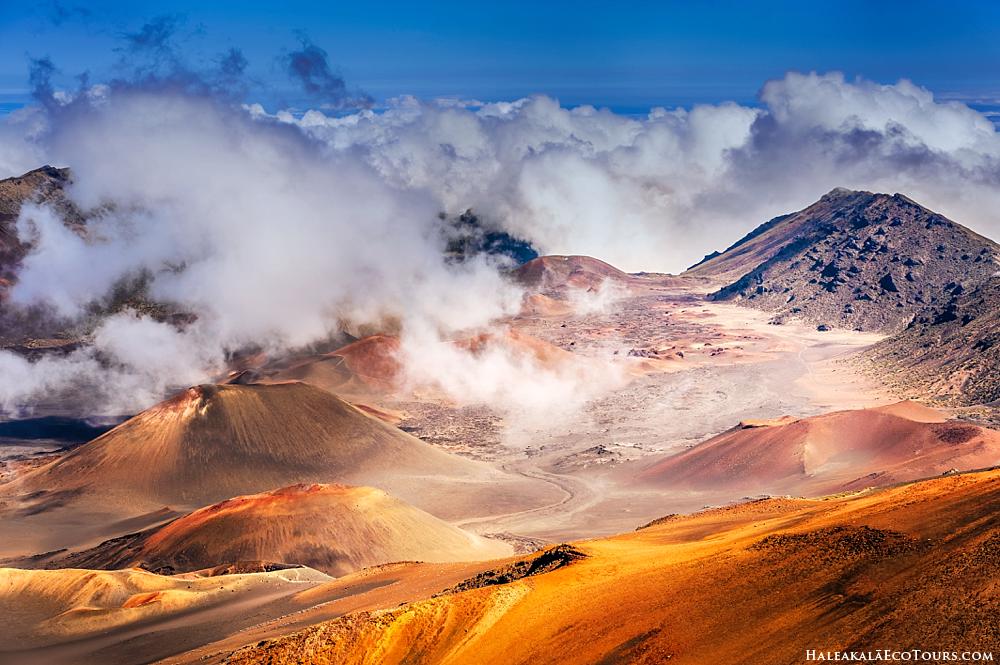
As Maui’s loftiest peak, it soars 10,023 feet above sea level and holds the title of one of the world’s largest volcanoes. Its crater alone is cavernous enough to cradle all of Manhattan Island. Comprising over 30,000 acres (more than three-quarters of the island), its crater also received global acclaim for going down as the quietest place on the planet—a place that’s at the very threshold of human hearing.
IMPORTANT NOTE: Haleakala is thought of as dormant by many, but it still has one eruption left in it! So technically, it is still an active volcano.
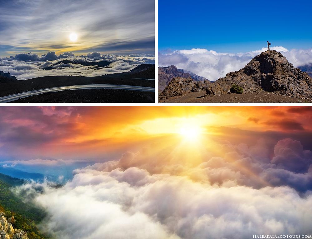
While its beauty is worshipped daily—1.5 million visitors climb its acme annually (to say nothing of its significance in native Hawaiian practices)—its past remains below the surface for many. How did this enormous mountain arise from the center of an ocean?
Haleakala and the Creation of Hawaii
Hawaii is unique for far more than its golden-sand beaches and aloha spirit.
Unlike other archipelagos around the world—the Aleutian Islands, for example, which are the result of the North American and Pacific Plates crashing—Hawaii was fashioned by a phenomenon known as hot spots.
First identified in the early 1960s by Canadian geophysicist J. Tuzo Wilson, hot spots are volcanic territories believed to be fed by abnormally hot underlying mantle—that is, the layer between the Earth’s crust and the outer core. Hypotheses differ, but the prevailing theory is that hot spots are owed to mantle plumes—upsurges of aberrantly hot rock within the Earth’s core.
That core rests below the rocky blocks that make up the planet’s outer crust. Given that Earth is an active planet, the plate to which Hawaii has anchored moves over time, and when it inches over this hot spot, the heat—which reaches a scorching 2,500 degrees Fahrenheit—effectively acts as a colossal blowtorch, thereby converting rock into magma: blistering-hot liquid rock that transforms into lava when it cools. The magma continues to rise until it hits the seafloor, where it hardens into an underwater mountain.
But these mountains differ wildly from, say, Mount Everest, which was created when the continent of India collided with Asia.
Rather, volcanoes are characterized as such by possessing a crater (or opening) through which material hotter than its surroundings flares through its interior. Over tremendous stretches of time—and over a number of eruptions—volcanoes accrue enough solidified lava to burst out of the ocean’s surface, thus forming an island.
In Maui’s case, that island was once part of what’s known as a “large volcanic massif”—an immense expanse of lava that’s prone to displacement.
Dubbed “Maui Nui,” this single island spanned more than 5,600 square miles before glacial changes, subsidence, and erosion filled the flatter planes between the volcanoes with water. Mauna Kahalawai (which “built” the West Maui Mountains) and Haleakala remained connected by the central isthmus of Maui, thus giving rise to the island’s eventual nickname of the Valley Isle. The rest of Maui Nui, meanwhile, separated to form what we know today as Kaho’olawe, Lanai, and Molokai.
Learn more about the Best Haleakala Tours.
An Assembly Line of Islands
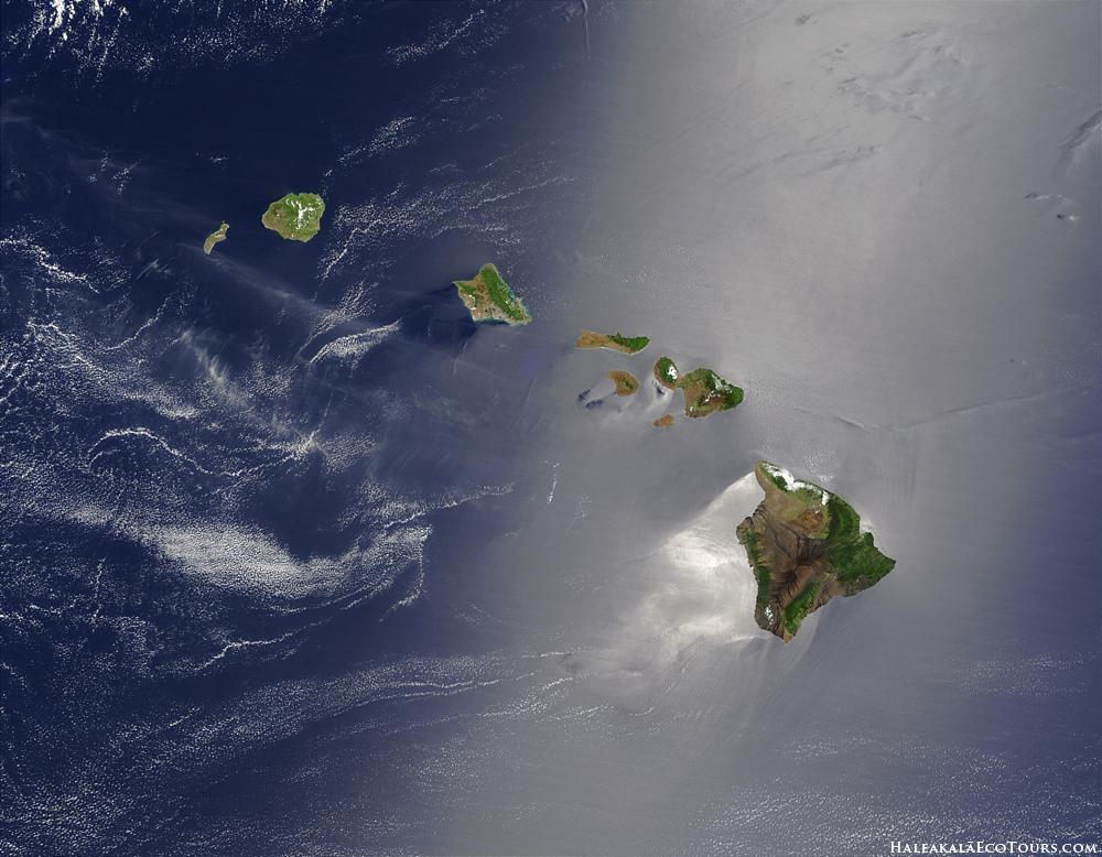
But to look at a map of the chain of islands that makes up the Hawaii we know today is to grasp, on a deeper level, how active Earth actually is. Kauai isn’t only the northernmost island in the chief archipelago—it’s also the oldest, having been formed approximately 5 million years ago when the Pacific Plate struck the hot spot. (The hot spot is fixed, but the plate—as all of Earth’s tectonic plates—continues to move.) “As the rocky seafloor slab inches along,” Live Science writes, “it carries the island beyond the hot spot, cutting it off from its lava source. The cycle of birth and extinction has left behind a trail of islands.” In other words, as plates shift over the hot spot, the volcano is shut off from the magma chamber beneath. Magma—which you can think of as intensifying under pressure—finds a new source to the surface through the undersea mountains that plait our ocean floor, consequently establishing a new active volcano.
To illustrate this further, consider the Big Island. At a mere 300,000 years old, it began forming 4.5 million years after the birth of Kauai—and, since it presently remains on top of the hot spot (we didn’t say that Earth’s activity was necessarily fast—indeed, the plate moves roughly 10 centimeters per year), it continues to enlarge today with active eruptions from four of its six volcanoes: Mauna Loa, Kilauea, Hualalai, and Loihi, with Kilauea having the most activity and Loihi remaining—for now—underwater.
A Workshop of Nature
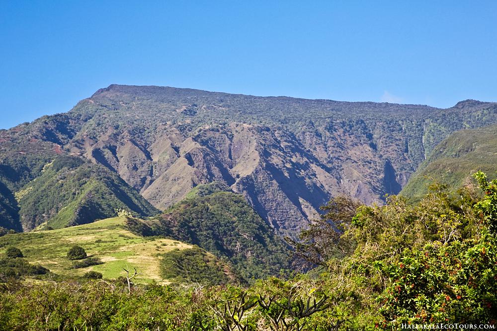
Maui, on the other hand, is the second-largest and second youngest island Hawaiian island in the chain—with its eastern half, created by Haleakala, coming in at 750,000 years old. Its last eruption took place in 1790 and radically altered the island’s southwestern coast, creating what we’ve come to identify today as La Perouse Bay. (The area, traditionally called Keone’o‘io, continues to contain evidence of Haleakala’s youth: Much of this region is characterized almost entirely by a’a (or lava rock), while sand—which requires time, weather, and erosion—is scant.) As Maui drifted away from the source of its origin, the hot spot found a new venue of (albeit massive) release, creating the island of Hawaii—a landmass that, at 4,028 square miles (and growing) is larger than all of the other Hawaiian Islands combined. Meanwhile, its crowning jewel—Mauna Kea—is the tallest mountain in the world when measured from the seafloor.
The extensiveness of the Hawaiian Island archipelago is further testimony to the hot spot’s incredible potency.
While we tend to think of Hawaii as the eight primary islands that are most commonly visited and inhabited—Maui, the Big Island, Molokai, Lanai, Oahu, Kauai, Ni’ihau, and Kaho’olawe—Hawaii’s archipelago actually contains 132 islands, atolls, shallow banks, shoals, reefs, and seamounts—ultimately spanning more than 1,500 miles of the Pacific Ocean, or twice the length of California.
While it may be unfathomable for some to consider that this hot spot fashioned a mountain that’s over eight times as tall as the Empire State Building, Haleakala, in its adolescence, was even larger—over 30,000 feet from its foundation on the ocean floor and 12,000 feet above sea level. When Haleakala’s eruptions were temporarily halted, erosion took over. Due to its towering height, Haleakala was able to ensnare the moisture-rich trades, bringing rain to the mountain. Streams formed, carving grooves into its slopes. When volcanic activity recommenced, lava packed the gullies. It also gushed forth from the younger flues and created cinders, volcanic bombs (masses of molten rock that cool into concrete fragments before they even reach the ground), spatters, and ash—all of which came to resemble the dramatically beautiful, otherworldly crater revered in our modern era.
The Future of Hawaii
But as powerful—even invincible—as Haleakala and the other volcanoes of Hawaii may seem, each are vulnerable to the forces of erosion that have fashioned the shapes we see today. Such erosion—due not just to patterns in wind and weather but also to the cessation of active volcanism as the plates (and islands) drift away from the hot spot—leads to a slow but steady shrinking of the islands. This, combined with rising sea levels—an effect of global warming—results in a literal, and conspicuous, wearing away. As the U.S. News and World Report states, more than 70% of Kauai’s beaches are eroding, while Oahu—the third oldest island in the chain—has lost a quarter of its sandy shoreline. In time, Maui and the other islands in Hawaii will submerge below the surface of the ocean, thereby becoming obsolete—and thereby rendering our time here on the Valley Isle all the rarer and more precious.